KU Leuven Maps Grasslands in Flanders to Study Their Response to Climate Extremes
KU Leuven has developed a new grassland dataset for Flanders, combining agricultural land use and ecological value to study how different grassland types respond to drought
 Elisabeth Allaert (KU Leuven)
•
Oct. 23, 2026
As part of BioClima, KU Leuven has developed a comprehensive grassland dataset for Flanders, northern Belgium. Combining information on agricultural land use and ecological value, the dataset will support research into how different grassland types respond to climate extremes such as drought.
Grasslands as agricultural and ecological landscapes
Grasslands are an integral part of the landscape in Flanders, covering approximately 27% of the region’s surface. Most play an important role in the feed production chain, providing hay and grazing opportunities for livestock.
Beyond their indispensable role in agriculture, grasslands often have high ecological value as well. They can act as hotspots for insects and provide refuge for locally endangered plant species. Grasslands provide a wide range of ecosystem services and represent the most widespread semi-natural ecosystem in Flanders.
Understanding how grasslands respond to climate extremes such as drought, which are becoming increasingly frequent and severe due to climate change, is essential. However, because grasslands fulfil both agricultural and ecological functions, information on their occurrence is scattered across different datasets.
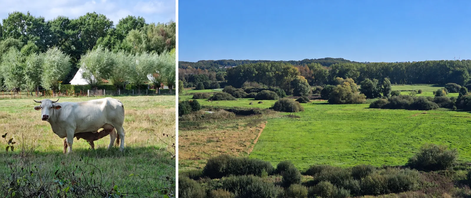
Illustration of the two main land uses for Flanders’ grasslands: cattle feed and roaming in West Flanders (left) and ecologically important semi-natural grasslands in the Demer Valley (right).
Photos: Elisabeth Allaert, KU Leuven.
Combining land use and ecological value
To obtain a comprehensive overview of grassland distribution in Flanders, two key datasets were combined: one describing agricultural land use and another identifying biologically valuable areas. Both datasets contain a large amount of information, which was carefully filtered to create the new grassland dataset.
In the final product, information on land use type and ecological value was retained. The land use type indicates whether a grassland is primarily used for agricultural purposes or not.
In addition, each grassland was assigned to one of five categories based on its ecological value and biodiversity. These categories range from species-rich semi-natural grasslands to grasslands with limited ecological value, providing a broad picture of the diversity of grasslands present in Flanders.
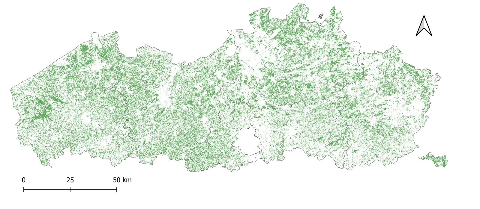
Overview of all grasslands in Flanders as identified by the newly developed dataset.
Map: Elisabeth Allaert, KU Leuven.
Studying grassland responses to drought
With this comprehensive grassland dataset now available, the next step is to explore how grasslands across Flanders respond to climate extremes. The exceptionally hot and dry summer of 2026 provides a unique opportunity to study drought impacts on grassland resilience in detail.
By combining the dataset with satellite-derived Essential Climate Variables (ECVs) and Essential Biodiversity Variables (EBVs), such as leaf area index (LAI), fraction of vegetation cover (FCOVER) and fraction of absorbed photosynthetically active radiation (FAPAR), the team aims to uncover how different grassland types cope with extreme drought conditions.
Based on a contribution from Elisabeth Allaert, KU Leuven.